Riversides
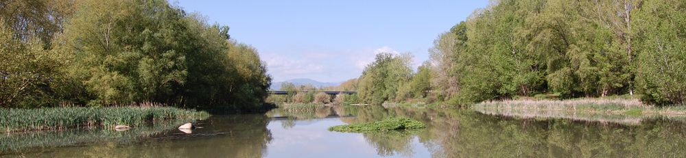
Rivers create a diverse range of landscapes, while also being a defining feature of the scenery. The majority of human settlements are associated with water sources, and in many cases there has been a gradual rediscovery of rivers and streams over recent years, with restoration and regeneration projects, and the new spaces created for the public to enjoy the riverside. River courses have also become part of the identity of a village, a city or even an entire country.
Many industries and industrial estates have also been defined by the course of rivers throughout history, either through the need to use water (such as company towns producing textiles) or because of the tendency to locate businesses on the outskirts of urban centres. Similarly, a majority of crop-growing fields on farmland require irrigation canals and reservoirs that use river water. Moreover, the upper and middle courses of major rivers often include multiple locks and canals, normally related to small hydropower plants built at the end of the 19th and beginning of the 20th century, and to the large reservoirs built during the '60s.
Rivers are also extremely valuable as ecological corridors for the environments and habitats along the riverbanks, and they create high levels of biodiversity. Another important aspect are the final stages of rivers and their estuaries, which often form wetlands and river deltas, and have an impact on the coast and how beaches and sand dunes are formed.
It is therefore important to ensure rivers and their surroundings are managed and maintained correctly. The landscape catalogues of Catalonia have defined measures that can serve as a basis for working towards the following three objectives in relation to riversides:
- Conserving and appreciating our hydraulic heritage.
- Preserving and improving the quality of the scenery around river courses.
- Improving the quality of river areas, their relationship with urban areas, and how they are used by society.
Some tools and measures that can be applied by municipalities are:
- Creating an inventory of assets that include all the historical and cultural attributes of river areas, both in terms of material assets (mills, dams, canals, bridges, aqueducts, etc.) and immaterial assets (myths, legends, stories, etc.). Where possible, drafting plans to preserve, organise and manage these assets.
- Maintaining the architectural heritage linked to the canals and water infrastructure, while respecting the continuous use of canals and irrigation systems over time. Where changes need to be made in the landscape as a result of necessary changes to farming systems, the actions taken must be in accordance with guidelines for pre-existing farmland.
- Ordering the historical canal and water infrastructure assets that would most improve the aesthetic value of the area, adding them to the new municipal urban planning guidelines. Including these assets as the framework for urban buildings and/or a network of open spaces. They could also be included in the Catalogue of Assets in the general plan.
- Strengthening the image of the historical canal system and the water infrastructure as an identity symbol, by sharing its values and adapting the mechanisms so they can be discovered and explored.
- Making the most of the scenic value of certain dams, especially those that are intrinsically beautiful or that could undergo improvements for social use (such as counter-dams on the edge of weirs), in order to appreciate the scenery surrounding water reservoirs.
Some tools and measures that can be applied by municipalities are:
- Protecting and restoring river and lake areas, viewing them as basic systems that define the countryside. Recovering and strengthening the function of river and lake areas in terms of the environment and their social, cultural and aesthetic value.
- Categorising river courses and their immediate area of influence as priority areas for conservation: from the sources in the mountains, to courses through urban centres, routes through farmland, etc.
- Ensuring a minimum ecological river flow is maintained, in order to sustain the ecosystems along the riverbank, as well as the quality of the water, and to avoid stretches of the river with low quantities of water caused by excessive use upstream.
- Encouraging environmental integration for public works that have an impact on river flow. In terms of scenery, pipelines and underground watercourses are discouraged.
- Restoring and renaturing deteriorated stretches of riverbanks, using native species from the river ecosystems at each location.
- Restoring and renaturing deteriorated stretches of rivers and streams where they are located near urban centres, industrial estates and the suburbs, prioritising areas that show clear signs of deterioration and those that are inhabited by native species.
- Valuing agricultural landscapes on alluvial plains, whether used for vegetable gardens or cultivating fruit crops, and which are defined by lineal plots of land perpendicular to the course of the river.
- Strengthening environmental stewardship agreements around rivers.
- Guaranteeing the survival of crops on the wetlands in order to ensure the continuity of aquatic ecosystems and ensuring their stability.
- Adopting integration and landscape improvement measures for all the existing hydraulic and auxiliary infrastructures along the rivers and lakes in the Pyrenees. Encouraging electricity generation via small waterfalls, for local energy consumption.
Some tools and measures that can be applied by municipalities are:
- Considering rivers as a determining factor in municipal planning. Aiming to prioritise these transitional areas for use as open spaces, and guaranteeing that new buildings will allow for visibility between the town and the waterfront.
- Treating urban waterfronts carefully, within the framework of an urban plan, (including façades, walkways, parks, urban promenades, etc.) in order to highlight them and enhance their natural scenic beauty.
- Establishing basic guidelines to remodel and adapt buildings along the riverside with the aim of recovering the homogeneity of the waterfront. In many cases the uniform appearance has been lost due to a large number of buildings, low quality of architecture, and the dissonance between different colours and textures.
- Recovering, preserving and promoting open views of the river.
- Drawing up studies on landscape conditioning that include the participation of local citizens, referring to the urban stretches of the main river courses, in order to make the most of these areas as corridors between town centres and open spaces.
- Creating specific lines of support to improve buildings or areas along the river in urban or suburban areas, offering tax reductions or exemptions for carrying out construction work that will improve the riverside, such as adapting or building small promenades by the riverside.
- Extending public use and access to the river through paths alongside the river, discovery trails, viewpoints, bridges over the river, etc.
- Encouraging and improving public use of rivers and bodies of water (bathing areas, controlled fishing areas, areas for sailing, etc.) as a way to bring the local population to the riverside, to reservoirs and lakes, and as an asset for local economic development.
- Carrying out educational activities in the area, rediscovering the history of the area and promoting river areas, both in town centres and in the areas of environmental interest located in river banks. Associating these activities with school trips, special events, local festivities, etc.
- Demonstrating the intangible heritage linked to river courses, such as the myths, legends and imaginary characters that form part of the collective imagination.