Peripheral areas
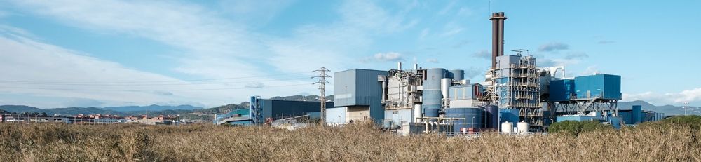
The majority of peripheral areas are the result of a chaotic mix of elements, structures, uses and functions. This includes road and motorway networks (often accompanied by petrol stations, service areas and shopping and/or leisure centres), secondary roads and railway lines, facilities for extracting resources, farmland, natural areas, forests, rivers, electricity networks and stations, farms and other isolated houses, densely-populated residential neighbourhoods, scattered housing developments, small and large industries located nearby major roads, and more.
Some of these landscapes still retain traces of the surroundings and their pre-existing natural, cultural and social functions (such as rivers, streams, orchards, traditional crops, company towns, bridges and irrigation channels). They often include valuable wildlife corridors, fertile areas for cultivation, harmonious and balanced areas, river banks and fields, scenic backdrops, spaces to meet and enjoy the outdoors, but they are often little known or at risk of disappearing. In other cases, the outskirts are neglected, dilapidated, abandoned and banal. It is precisely this state of neglect that can be the perfect setting for putting creative and imaginative projects into place, from an economic, social and environmental perspective, with the integrated and synergistic approach that these landscapes require.
It is important to see the outskirts, too, as areas for opportunity: in terms of the economy (starting with agriculture), entertainment, culture, transport, energy production, and more; spaces that add value to both cities and rural areas. In the current context of a globalised economy, characterised by growing competition between regions, the quality of the landscape and its uniqueness are two factors that are increasingly important, especially for companies in advanced sectors (technology, information, innovation, etc.), as well as in terms of leisure and culture. The quality of the landscape, therefore, acts as a factor for competitiveness and sustainable development.
All in all, it is crucial to improve the quality of the outskirts, and do this hand in hand with the local population. This will depend, in particular, on the management style adopted at a local level and the role of the parties involved. It is important to imagine more flexible concepts and measures to design more personalised outskirts, where reversibility is a key factor.
That is why the landscape catalogues of Catalonia have defined measures that can serve as a basis for working towards the following objectives in relation to peripheral areas:
- Organising and integrating urban extensions, activities and infrastructure into the landscape of peripheral areas
- Recovering and enhancing connectivity between peripheral landscapes to improve the transition between open spaces and urban centres
Some tools and measures that municipalities can apply are as follows:
- Defining a level of population density that respects the clear relationship between the city and the countryside, and that ensures that urban development will remain in the existing urban areas and respect the historical use of the land, without permitting any further loss of fertile soil.
- Limiting the impact of new builds in urban areas as far as possible, especially in areas with particular aesthetic or scenic value, and avoiding buildings in areas that break up the landscape and/or modify the features, profile, landscape, or traditional urban skyline.
- Incorporating natural elements into the urban framework.
- Gradually relocating isolated industries to industrial estates, in order to prevent buildings from spreading.
- Prioritising the location of new projects in growth sectors and adjacent areas that are already urbanised or built up, in order to optimise existing infrastructures and services.
- Minimising the visual exposure, built-up land and landscape fragmentation caused by businesses and services.
- Drawing up landscaping plans for the business activities next to roads in city entrances with visual impact (buildings, outdoor exhibitions, adjacent facilities) that also include guidelines on the colour scheme and signage.
- Improving the quality of the landscape in peripheral areas through strategies and projects that either restore the original landscapes in the area or to add new uses and meanings to it.
- Encouraging the dismantling and removal of buildings and facilities that are unused.
- Prioritising the placement of solar parks in areas in a poor condition following activities such as extraction, and in residual areas (such as traffic islands, roundabouts or spaces between roads) and areas near infrastructure (strips alongside motorways or power lines).
- Developing guidelines to improve the landscape in residential areas, industrial estates, tertiary areas, marginal spaces and disuses areas (quarries, landfills, factories and isolated industries, etc.) in the municipality, ensuring that each municipality incorporates them in municipal urban plans.
- Avoiding the loss of further scenic landscapes around airports, and looking into the capacity of the infrastructure to allow for high-equality scenery, especially when considering that these surroundings often act as gateway to the country, and are therefore the first impression for visitors.
- Identifying, documenting and mapping the links between peripheral areas and the past, in order to maintain the identity of peripheral areas (local knowledge, historical monuments, houses, paths, fields, irrigation ditches, streams and canals, mills, forges, natural drainage networks, and the relationships that exist between them and other features in the landscape over time) and to provide guidelines for urban planning, cultural planning and business plans.
Some tools and measures that municipalities can apply are as follows:
- Strengthening green belts, which also means restoring areas that are in a poor condition, improving access to these spaces, and promoting land stewardship.
- Ensuring a network of farmland that is as broad as possible and with minimal divisions, that strengthens its role as a link between rural and urban life, and responds to consumers who are increasingly concerned about the quality and safety of their food.
- Recovering and strengthening suburban allotments so that they contribute to the rebuilding a collective feeling of belonging, and contribute to an important social, cultural and productive revival.
- Creating areas that improve the landscape (sports facilities, parks, etc.) to ensure a clear and harmonious transition between urban centres and open spaces.
- Promoting a network of paths and trails for public use that link urban centres to open spaces and allow people to use and enjoy them.
- Preserving, as far as possible, the continuity and cultural value of rural roads, motorways, trails, paths and other historical routes that have been affected by newer transport infrastructure.
- Identifying and marking scenic urban routes, especially those that continue outside urban areas and those that are part of historical and/or environmental routes.